Bryton
Bryton Rider 750 T
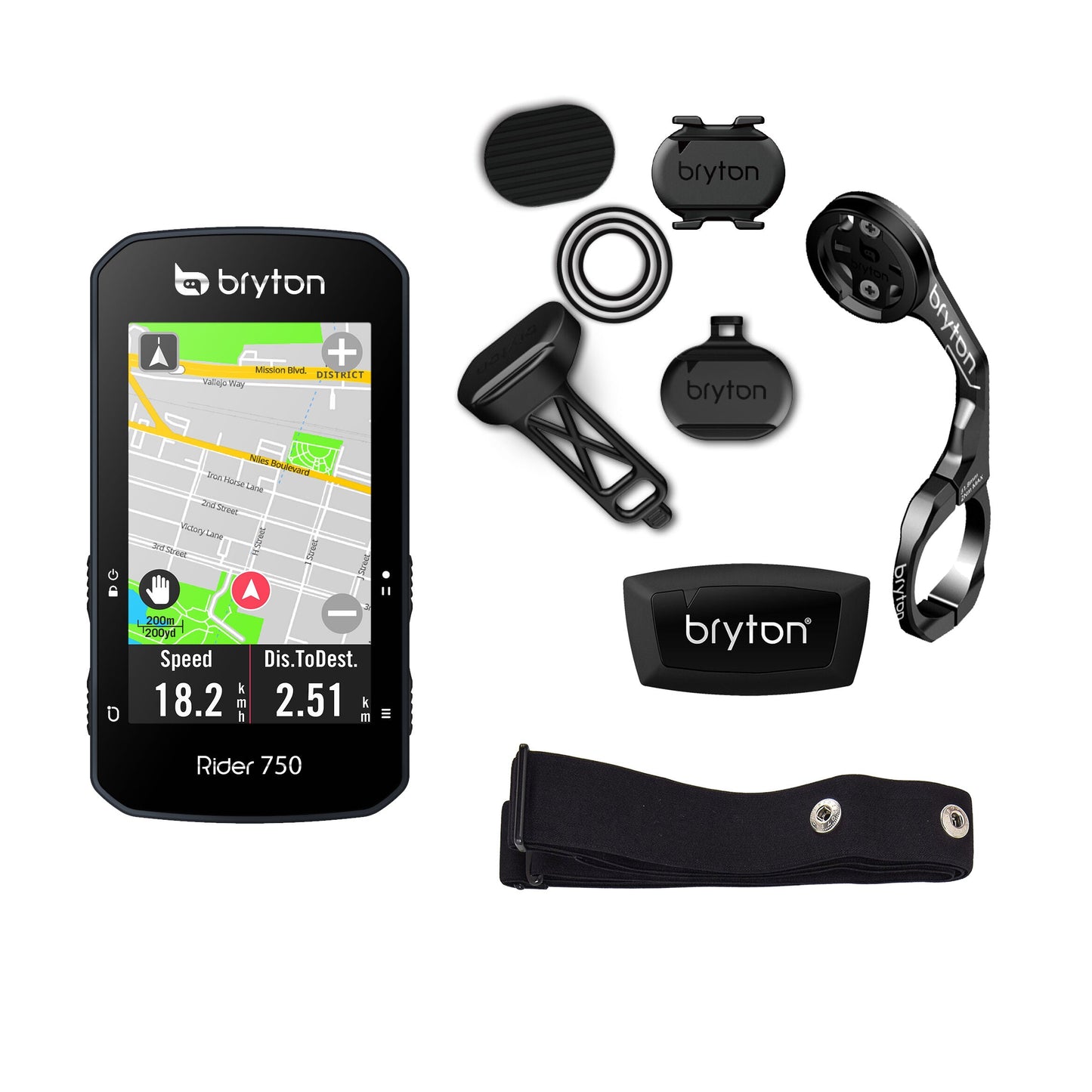
Bryton Rider 750 T
Couldn't load pickup availability
Bryton Rider 750 T
For cyclists looking for powerful new features and technologies, Rider 750 incorporates online navigation with preloaded maps and advanced workouts, combined with new features such as the Bike Radar System and Smart Trainer support.
General
-
Physical dimensions
49.4 x 92.3 x 19.65 mm
-
Display resolution
240 x 400 pixels
-
Operating temperature
-10°C~50°C
-
History Log
300 hours
-
Satellite support
GPS, Glonass, Galileo, Beidou, QZSS
-
Alarms
Yes
-
Display size
2.8 inches/7.11 cm
-
Waterproof
IPX7
-
Lap History
130 laps
-
Battery life
Up to 20 hours
-
Display type
2.8“ color TFT LCD
-
Touch screen
Yes
-
Barometric altimeter
Included
-
Wireless
WLAN and Bluetooth
-
Support compatibility
Bryton proprietary support systems (third party supports are not covered under warranty)
Connectivity
-
WLAN
Yes
-
Bluetooth sensors
-
-
ANT+ sensors
HR, cadence, speed, power, electronic shifting
-
Compatibility of electronic shifting systems
Shimano Di2, SRAM, eTap, Campagnolo EPS
-
Bryton Active compatibility
Bluetooth (iOS & Android)
-
Auto-sync with third-party platforms
Strava, TrainingPeaks, Selfloops, Relive, today's plan
-
Software / GNSS update
Bryton Update Tool/Bryton Active App/WLAN
-
GoldenCheetah compatibility
Yes
-
Bike Radar
Yes
Cycling functions
-
Adjustable backlight
Yes
-
Time/distance alarms
Yes
-
Maximum data/pages
12 / 8
-
Notifications
Yes (incoming/missed calls, messages, emails)
-
Automatic task loading
Yes
-
Pause/Lap/Auto Scroll
Yes
-
Altitude/Slope/Temperature
Yes
-
Bike profile
Up to 3
-
Recording 1 sec.
Yes
-
Download routes to your device
Yes
-
Advanced training
Yes
-
Customizable data grid
Yes (On device/Bryton Active)
-
Alarms
Yes
-
Summary about the device
Yes
-
Energy saving satellite mode
Yes
Navigation
-
Integrated base map
Yes
-
Download global maps
Yes
-
Track navigation
Yes
-
Navigation (redirection)
Yes
-
POI/address search
Yes
-
Note: Rider 750 comes with preloaded maps of major regions, but if the map does not appear on your device, please go to DOWLOAD > MAP on the site to download maps specific to your area.
-
Plan itineraries
Yes
-
Get back on track
No
-
Advanced Track Follow
Yes
- • EN
- • FR
- • DE
- • NL
- • IT
- • ES
- • PT
- • PL
- • HU
- • JP
- • TH
- • TC
- • KO
- • RO